At the very end of Long Island's North Fork, where the land narrows to a thread between Long Island Sound and Gardiners Bay, sits Orient — a place that has been farmed, fished, and cherished for nearly four centuries, and whose name was once simply the abundance found in its waters.
01 · Before the SettlersThe Corchaug homeland
Long before English ships appeared in the bays, the eastern North Fork was the country of the Corchaug, an Algonquian-speaking people whose name for this land was rendered by colonists as Yennecott. The eastern point itself they knew as Poquatuck. The Corchaug lived by the same waters that would later define the place — harvesting shellfish, fishing the Sound, and tending the cleared land that the first colonists would find ready for planting.
In the years just before 1640, magistrates of the New Haven Colony in Connecticut purchased title to the land reaching from the eastern point west toward Wading River. The North Fork would be settled not from the west, but from across the Sound.
02 · 1640The settlement of Oysterponds
In 1640, a company of settlers led by the Reverend John Youngs crossed from New Haven and founded Southold — among the oldest English towns in New York. From that beachhead, families pressed eastward down the fork. By the mid-1640s the far eastern neck was being settled by a handful of founding households whose surnames still echo across the hamlet: Tuthill, Youngs, King, and Brown.
They named the place for what they found in its waters. The tidal ponds here teemed with shellfish, and the eastern neck became Oysterponds. The ponds themselves formed a natural divide: the western half was the “Upper Neck,” the eastern half the “Lower Neck.”
03 · Brown's HillA founding family and the oldest ground
Among those first families were the Browns — Israel and Samuel Brown appear among the earliest settlers — and it is from them that the rise of land known today as Browns Hills takes its name. The Brown's Hill Burying Ground, set aside not long after the community took root, is one of the oldest graveyards on the eastern fork, still ringed by a wall of loosely stacked fieldstone that has held its line for more than three centuries.
The Brown's Hill area also carries a quieter, important history: a separate burying ground for enslaved and free African Americans who lived and labored in early Orient — a part of the record that local historians and preservation groups have worked in recent years to honor and protect.
04 · The Maritime CenturyOysters, sail, and the journal of Augustus Griffin
Through the 1700s and 1800s, Orient lived by the water. It was a community of saltwater farmers, baymen, coasting captains, and shipbuilders; oystering took commercial hold in the early 1800s and never entirely let go. Houses from this era still line Village Lane, and the Village House — built in 1798 by the diarist Augustus Griffin (1767–1866), whose journal remains one of the great firsthand records of life on the eastern fork — survives as a centerpiece of the hamlet's preserved core.
That heritage is kept today by the Oysterponds Historical Society, whose seven historic buildings and collection of tens of thousands of objects — whaling logbooks, manuscripts, furnishings, and Griffin's own journal among them — tell the story of the place from the inside.
05 · 1836How Oysterponds became Orient
By the 1820s the two necks had drifted into separate identities, and in 1826 they formally split. A decade later, in 1836, the Lower Neck applied for its own post office under the name Oysterponds — and was refused, the name judged too close to Oyster Bay, seventy-five miles to the west. The Post Office Department offered an alternative fitting for the easternmost community on the fork: Orient. The name stuck. The Upper Neck, in time, became East Marion.
06 · The Summer ColonyLight, water, and a destination discovered
In the second half of the nineteenth century, the very things that had made Orient a hard-working maritime outpost — water on three sides, clear light, and distance from everywhere — made it a destination. Orient lays claim to one of the oldest summer resorts on Long Island, and boarding houses and summer cottages spread through the hamlet as visitors came for the air and the shore.
At the point itself, the Orient Point Lighthouse — the cast-iron “Coffee Pot,” lit in 1899 — still marks the passage where the Sound meets Gardiners Bay, with Plum Island beyond. To the south, the long sandspit that became Orient Beach State Park preserves a rare maritime forest found in only a few places on the eastern seaboard.
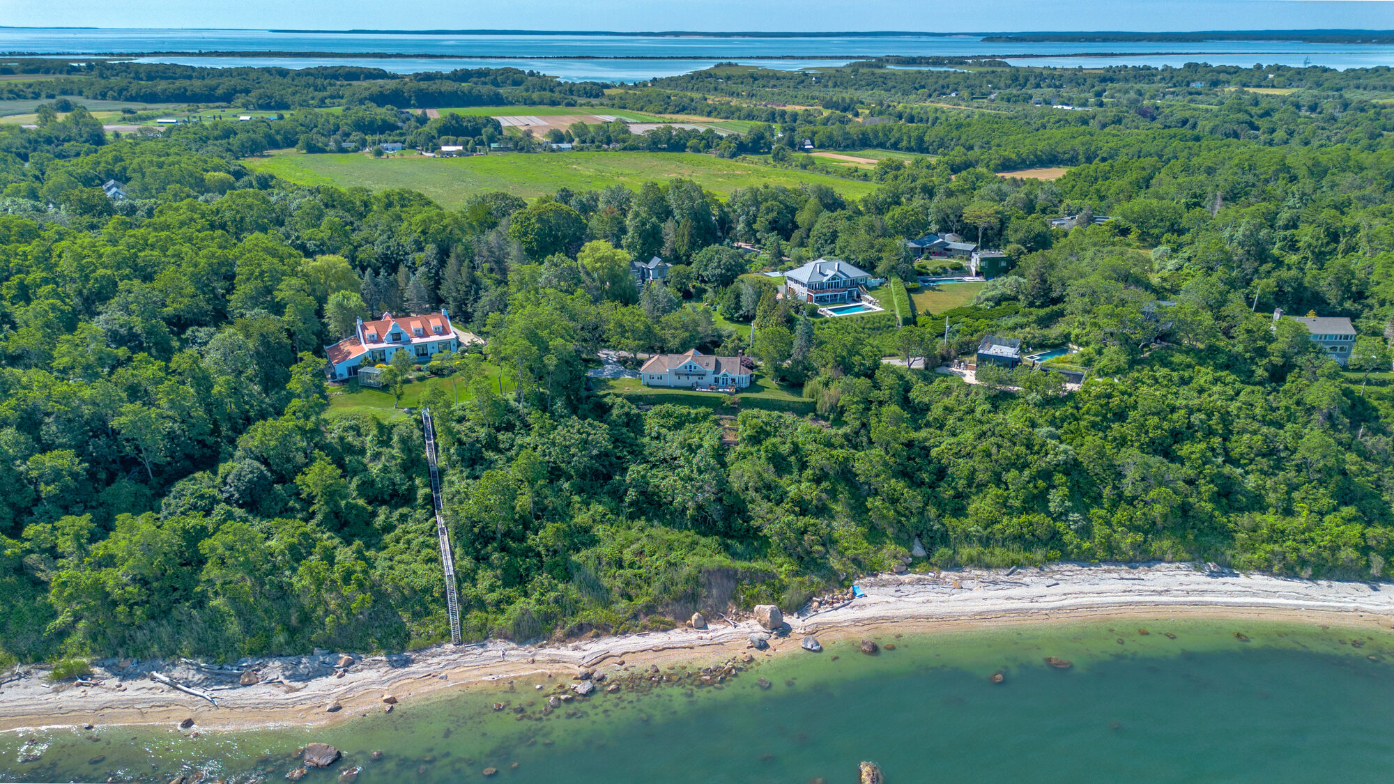
07 · The BluffBrown's Hills Estates and 30 North View Drive
The summer-colony era is what shaped this corner of Browns Hills. In the mid-twentieth century, the high bluff ground along Browns Hill Road and North View Drive — overlooking Long Island Sound — was subdivided as Brown's Hills Estates. In 1959, a Sound-front summer cottage was built among them for Dr. John R. Whittier; nearly three decades later, in 1988, it was reconstructed and enlarged into the two-story residence that stands today at 30 North View Drive.
Held by a single family for almost forty years before changing hands in 1998, the house sits on ground that traces directly back to the founding name on the hill.
Orient at a glance
- Native landCorchaug homeland; known as Yennecott / Poquatuck
- 1640Southold founded by Rev. John Youngs' company from New Haven
- c. 1640sEastern neck settled — Tuthill, Youngs, King, Brown
- 1798Augustus Griffin builds the Village House on Village Lane
- 1836"Oysterponds" renamed Orient for its easternmost location
- 1899Orient Point "Coffee Pot" Lighthouse lit
- 1950sBrown's Hills Estates subdivided on the Sound bluff
- 1959 / 198830 North View Drive built, then rebuilt as it stands today
Sources & further reading: Oysterponds Historical Society; Town of Southold — History; Brown's Hill Burying Ground records. Historical details are drawn from public local-history sources and should be independently confirmed before publication.